Wednesday, September 4, 2013

IMTUF 100 Report - 8/30/2013


I kind of stumbled onto the IMTUF 100 by accident. As I was looking for a late summer mountain 100 miler, I discovered Jeremy Humphrey's 2012 Cascade Crest 100 race report at his website, Stay Vertical. Perusing through some of the other blog entries, I learned of IMTUF, and Jeremy's love and enthusiasm for his McCall, Idaho trails was clear. With a little correspondence I was sold and chose to race in Idaho in August over a handful of alternative races around the country.


Despite being my focus race for the year, my preparation for IMTUF turned out to be anything but focused. My weekly training mileage through late winter and spring was sporadic and inconsistent as I tried to balance family, work, and other hobbies with running. A surprise entry slot into the Vermont 100 six weeks before IMTUF and then a punishing mountain run across the Mahoosucs two weeks out didn't really do my legs any favors and I began to fear I'd dug myself into a hole of fatigue. My taper was equally spastic, with lots of beer and only two runs in the final weeks before IMTUF. This is not a training plan you'll find in any book and probably bodes poorly for any future career prospects I might have as a coach.


At the start, my confidence level was low and I warned my crew that there was a very real possibility my legs might give out under the abuse of the last two months, leaving me struggle to finish within the time limits. I told myself I was going to go out easy. No, seriously. For real this time. And the start did feel easy, but then again, it always does. Nobody else seemed interested in taking the lead on the dirt road that starts the race, and I found myself at the front from the very beginning. There were a handful of names on the entry list that I expected to share the early miles of the course with, but when we turned onto the Nethker Creek Trail to Bear Pete Mountain, I was soon alone.

I'd never lead a single step of a 100 mile race before, but it turned out that I'd lead every single one this time. When I rolled into the first major aid station at Upper Payette Lake around mile 15 my legs were feeling great. I was on top of the world after having run a series of gorgeous trails on an open ridgeline. So far the terrain had been a mix of flowing buff singletrack with a few intermittent moderately technical sections and a bit of forest road. If the rest of the course was anything like this, I might be able to challenge the course record. Jeremy Humphrey, one of the race directors, walked me out of the aid station and offered up some valuable beta on the course ahead, as well as advice to beware of patient, hungry runners behind me.


There are some advantages to leading, one of which is that you're more likely to encounter wildlife. Being from the East, I'd never heard an elk bugle before. It gave me a little thrill when one rang through the woods a bit before sunrise; a perfect way to start the day. Later on I'd encounter mule deer, a moose, and numerous grouse along the trail. Jogging up Pearl Creek Road to the Crestline Trail I also passed by a large flock of sheep grazing in the brush and tended by a pair of Peruvian shepherds. Crestline was spectacular, as advertised, with more open ridge running through meadows, over granite ledges, and by many old burn scars affording mountain views in all directions. Here the footing was a bit more technical, reminding me of Massanutten in many ways and my pace began to slow a bit in the heat of the day. I was frequently looking over my shoulder, but there were still no other runners to found.

There are also some disadvantages to running on the front. In my case, except for aid stations, I was alone for the entire race. No music, no pacer, and no one to talk to. I also had no idea how close second place was. There were intermittent reports that I'd established a substantial lead, but the information was hours old by the time it reached me and I often got conflicting reports. Was I gaining ground or losing it? Hours ahead or minutes? I had no real idea. Not that it made much difference. In any case I'd just keep pushing as best I could.

Jeremy escorted me again out of Lake Fork Trailhead (mile 44) while he checked the course markings at a few key junctions. He offered some valuable advice to take a dunk in Lake Fork Creek  when I reached it a couple miles down the trail. I waded into a pool and submerged my entire body, instantly feeling refreshed as I rinsed away nine hours worth of sweat, dust, and salt. This was renewal that would be needed for the very steep and rough climb over Snowslide Pass a few miles later. The sun began setting somewhere around Duck Lake Trailhead (mile 60) where my parents were waiting with clean socks, gel, and fresh bottles of Perpetuem, as well as my lights and warm clothing for the night. I usually get a bit of an attitude and energy boost in a race as things cool off around sundown and I was able to run most of trail returning to Upper Payette Lake (mile 70), only needing to turn on my headlamp for the last section into the aid station. I'd heard some distant howling through here, a couple miles above the road crossing. Wolves or coyotes, perhaps.


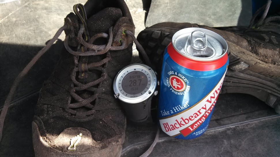
Upper Payette Lake was a bit of a low point for me. It was far enough into the race that the morning's enthusiasm had worn off, yet too far from the finish to feel the end drawing close. Thirty miles is a long way left to go. It'd been a few days since I'd seen my wife, infant daughter, and dog and missing them I felt gutted inside. My quads actually felt pretty good but my hip abductors in my outer thighs had tightened up severely, which limited my ability to run well. Additionally, my energy levels were fairly low and I found it difficult to run fast enough on flat ground to really elevate my heart rate. I've come to understand that low points like this are an integral part of hundreds, something that I fully expect to encounter. Overcoming them, just accepting that it's a roller coaster ride, and continuing on is crucial to being successful. All the rewards become apparent at the finish line and in the days following.

But the immediate reality was that I had an unjustifiably bad attitude and it took most of the steep, climbing plod up Victor Creek Trail to break out of my little pity party. I was feeling a bit better by the time the trail turned downhill and smoothed out some. When I saw mile 80 roll by on my GPS I grew happier and began counting own the remaining miles in my head. My folks met me one last time at Chinook Campground (mile 86) but there wasn't much I needed beyond some encouragement and a refill so I quickly headed out. The Loon Lake section of trail was another smooth and flowy section that I made fairly good time on, despite a few steep sections that I surely would have been able to run earlier in the day. Through here there were quite a few large toads hopping around and I had to be very careful not to step on any of them.

The last section from Willow Basket Junction (mile 92) is something of a blur for me. I remember looking at my watch and knowing that the course record of 21:06 had long since slipped away and that even a sub-24 hour finish was now in jeopardy. I struggled to get any kind of a rhythm and found it difficult to maintain focus. Everything was an excuse to stop or walk; gotta pee, gotta fix my shoes, I'm hot I need to take my jacket on, now I'm cold and I need to put it back on. And so forth. This is where a pacer can come in handy. Lucky for me I encountered a light coming my way, which turned out to be Jeremy out for a jog again (at 5 in the morning). He let me know that there were only 2.8 miles left and with his company I was able to run the remaining distance non-stop. The finish line knew I was coming and gave me a winner's welcome as I crossed the line in 23:52:58 for my first 100 mile win. It was a fitting way to complete my tenth 100 mile finish.


Maybe one of the best features of this race is the start/finish venue at Burgdorf Hot Springs, probably the most genuinely "rustic" places I've experienced. It was 100% unpretentious and I loved it. What better way to sooth fatigued muscles and sore feet than in a geothermally-fed  104 degree hot spring? Vermont 100's cold horse pond has got nothing on this.


I have to say, I feel like IMTUF's best days are ahead. While it's currently a young, small race it has everything to offer the adventurous mountain ultrarunner. I'm thankful Jeremy Humphrey, Ben Blessing, and their volunteers put on a top-notch event in a gorgeous area of the country. The aid stations were well stocked, the route was clearly marked, and the course was challenging. I had several races to choose from in late summer and I left feeling that I'd made the right choice.

 GPS data for the run: http://www.movescount.com/moves/move18059265

Thursday, August 22, 2013

Mahoosuc Traverse II - 8/17/2013

"Fastest known times", or FKTs, for the classic Presidential Traverse and Pemi Loop have been the subject of quite a lot of activity over the last few years, changing hands numerous times between a cast of a half dozen characters, though they have settled down recently as a result of Ben Nephew's reign of terror. While there's no shortage of natural, aesthetic routes to choose from in the Whites, attention has been focused on just a few areas. But there's another, less crowded route with an almost forgotten history of speedy runs in the Whites; the Mahoosuc Traverse.

By the numbers, the Traverse is just a bit more imposing than the Pemi Loop with a similar 30-ish mile distance and 10,750 feet of elevation gain (compared to 8,800). What sets it apart though is Mahoosuc Notch, a deep and narrow gorge filled with boulders to be clambered over and under. There are crevasses here that have swallowed moose whole, leading to broken limbs and a rather gruesome death for the poor creature. Much of the Traverse is shared with the Appalachian Trail as it crosses from New Hampshire into Maine and the Notch is reputed to be the hardest, slowest single mile of the entire AT. Heavily burdened backpackers have been known to take several hours of leaping, squirming, and crawling to pass through the Notch. Aside from that, the Traverse spend much time above treeline in beautiful alpine meadows, bogs, and ledges that make the trip entertaining from beginning to end.

As early as 1927 the Mahoosucs were run by Bob Monahan in 10 hours, 27 minutes. In "the late 40s" Albert List Jr. is reported to have run the range with Brooks Dodge in 10:15, peeling and eating oranges as they ran. For a while, this was the fastest time I could find, until Jeff List pointed me to an RMC newsletter article describing the adventures of Chris Goetze. In a summer of remarkable achievements, including the chopping of several hours off Herbert Malcom's record Hut Traverse time, Chris ran the Mahoosucs in 8:06:30 on August 28th, 1958.


And then... nothing for the next 55 years.

Last summer some friends and I did a casual run across the Mahoosucs and I wanted to return to see what kind of time a focused effort would yield. Knowing the terrain, I was quite impressed with Chris' achievement. Eight hours seemed like a stout but achievable time. And a record that's almost old enough for an AARP card? Now that's intriguing.

It's not clear exactly what route Goetze took or which direction he went (there are a couple minor variations possible), so I used my best judgement to choose the following:
  • Start at Grafton Notch State Park in Maine
  • Take the Old Speck Trail to the summit of Old Speck (4170')
  • Run the Mahoosuc Range Trail around the East side of Speck Pond and through Mahoosuc Notch
  • Continue on the MRT over the South peak of Fulling Mill Mountain (3395') with a short side trip to the summit of Goose Eye Mountain (3870')
  • Continue South over Mounts Carlo (3565'), Success (also 3565'), Cascade (2631'), and Hayes (2555').
  • Descend on the MRT (not the AT/Centennial Trail) to finish on Hogan Road in Goreham.

The distance and elevation gain of this route closely matches the reported 28.75 miles that Goetze did, while leaving out the snowmobile trails and dirt roads that provide access from the more popular parking area that's now located on Route 16.

To make a long report short, my day did not go as well as I'd planned. I made good time up Old Speck, reaching the summit in just over an hour, and ran down the spectacular steep descent to Speck Pond. Mahoosuc Notch went well enough, the rocks were a bit greasy, and I made careful but steady progress through the scrambles. Fulling Mill and Mount Sucess were great fun, as always. By the time I hit the ME/NH state line it was clear I'd been a bit slow on the first half,  which was to be expected with the big climb up Old Speck and the slow going through the Notch. As it turned out, the second half was far less runnable than I remembered. On the way up Cascade Mountain I began suffering from persistent cramps in my hip adductors and it when it became clear that I wasn't going to break eight hours, I took a ten minute rest at the summit. This was actually pretty enjoyable as I got to relax and chill out for a bit while I had a short chat with one of the many AT thru-hikers I saw that day. I jogged the remainder of the route, finishing up in 8:47:33.

Eight hours is indeed a very stout time, one I have a newfound respect for. It might be within my capabilities on a good day, but I haven't been doing enough real mountain running to be that strong this summer. Only four weeks of recovery since Vermont 100 certainly didn't help things either. Excuses, excuses...  One thing is for sure though; Chris Goetze was a mountain badass by anybody's standards and his record will live on. For now.

A few pics:

A 12 oz salute to Mr. Goetze

Mahoosuc Notch and the Presidentials from Old Speck (pic from last May)

Mahoosic Notch (pic from Wikipedia)
Ledges and Bog Bridges on Mount Success (pic from last May)

The memorable sign that marks the finish on Hogan Rd. You can't miss it. (pic from last May)

Splits:

  • 1:02:24 to summit of Old Speck
  • 1:20:16 to Speck Pond
  • 2:03:16 to entrance of Mahoosuc Notch
  • 2:32:18 to exit of Notch
  • 3:00:35 to  Full Goose Shelter
  • 3:36:23 to Goose Eye summit
  • 4:25:50 to ME/NH state line
  • 4:59:24 to Mount Success
  • 5:43:30 to Gentian Pond
  • 7:05:09 to Trident Col
  • 8:09:21 to Mount Hayes
  • 8:47:33 to Hogan Rd.


Monday, July 29, 2013

Loose Ends - 2013 Vermont 100


"Congratulations! A spot has opened for you to run in the 2013 VT 100 Endurance Race! Thank you for your patience during this process, we never imagined that we would fill up so quickly!!"

This was the beginning of an email that popped up on my phone three weeks before the Vermont 100 this year - not a lot of notice by anyone's standards. "Patience?" When I signed up in January and saw my name so far down the wait list, I promptly forgot about the whole thing for the next six months. My training lately would best be described as inconsistent, but I still jumped at the opportunity and immediately hit "reply".

Vermont 100 will always be a special race to me because it's where I ran my first hundred miler. I have many fond memories of crewing, pacing, and camping out here. The decision to come back was an easy one to make on the spot  for the usual reasons - to challenge myself, to enjoy 100 miles of Vermont scenery, to spend time with friends, and to relive old memories. But there was another reason; vengeance.


In 2010, with two hundreds under my belt, I thought I had it all figured out. Chasing a sub-twenty hour finish, I wrote a check my legs couldn't cash, and my quadriceps finally gave out around mile 92. Despite the best efforts of my pacer, it took over an hour to stagger the last mile to Polly's aid station at mile 95 where I dropped out. Dropping that far into a race will set you up for quite a bit of second guessing of every decision you made that day. While the feeling does fade over time, it still felt like unfinished business.


The night before this year's race brought a very intense thunderstorm with winds that threatened to rip the rain fly off my cheap tent (Ozark Trail's finest) and send my family scrambling for the car, but by morning the weather was warm and clear. Fireworks marked the 4 am start and off we went. Within the first couple miles I stubbed my toe on a rock and took a tumble in the dirt. Luckily I tucked and rolled into a somersault, getting off with only a scraped knee and a coating of mud. My starting pace was far too hard and that quickly became clear by the time I hit the marathon mark at 26.2 miles in 4 hours flat with my quads already starting to ache. There had been a long paved downhill on the way into the town of Woodstock that I'd let myself fly down with little restraint- my watch showing a high 6-minute pace for some of the mile splits. I really ought to know better by now. Maybe I could have gotten away with that had I been training hard since January, but things felt eerily like a repeat of 2010, so I backed off and slipped into damage-control mode. If my legs were going to last the rest of the race, I'd need to listen to them more closely.


Stage Road at mile 31.4 came and went in 5 hours, where I stopped just long enough for my father to swap out my single water bottle, give my daughter a sweaty kiss, and chug an entire can of Mountain Dew (it was extreme). I spent the long muddy climb up the backside of the Suicide Six ski area sending rather impressive belches echoing through the woods. Along the way I got to spend a few minutes running and chatting with Amy Rusiecki and Todd Archambault before finding myself alone again. A course-side photographer passed along news that I was somehow in 11th place and I felt my ambition come swelling back, my pace creeping up a bit, before my quads reminded me that I still had a long way to go. Don't get carried away. Run your own race.


One unique feature of this event is that there's a horse race held on the same course, starting only an hour later than the runners. In previous years the first horses have caught me very early on, but it wasn't until mile 40 that I heard my first hooves. I happened to be bending over to tie my shoelaces when I heard galloping and "Now that's a runner's butt!" from the rider passing by. I told her she was running late. She told me I was running early.

Around 8 hours (right on my 2010 pace) I rolled into busy Camp Ten Bears at mile 47.6. After spending so much time alone, it was nice to see lots of familiar faces, if a little bewildering, as I tried to say my hellos, get weighed in, get resupplied, and get out. From here, the course does a 22.6 mile side loop before returning to Camp Ten Bears and entering the last 30 mile section to the finish. I have to say, this loop not my favorite part of the course. It has many steep hills that are hard to stitch together into a rhythm as the day begins to heat up. By now the morning enthusiasm has long since worn off, but it's sill much too far to feel the pull of finish line. Luckily I had some company as played leapfrog with Bob Ayers and Nick Pedatella for a while.


The long pounding descent back into Camp Ten Bears at mile 70.5 is an easy place to go too fast. I know because I've made that mistake before - but not this time. I arrived in roughly 12:30 elapsed time, feeling a bit haggard but holding it together, and picked up my good friend Ryan who'd pace me the rest of the way. He was eager to go, as all good pacers are, and we made good progress though the late afternoon and into the evening.


Reaching Bill's Barn (mile 89) before sundown, we were right where I wanted to be time-wise. This was also where my race really began to unravel last time. Now I was slowing as it got dark and could that feel my quadriceps were very vulnerable, but if I was careful I could eke out the last 11 miles on them at a reasonable pace. We formed up with a loose cluster of runners in 9th thru 13th place, with many position changes on the steep ups and downs that define the closing miles of the Vermont course. I wasn't really so much concerned with passing anyone else as I was with passing my old self. We ran by several familiar spots, places where I'd desperately tried to stretch and massage myself back to life before, and it felt good to leave them under our heels.

Last time I barely made it to Polly's, this time we barely stopped. I knew a good finish was all but in the bag and Ryan worked me hard for the last few miles. We passed my good friend Nate, who was looking rather deflated,  just out of the aid station and he told me to hurry up for a sub-nineteen hour finish. I thought it was too late but started to surge anyway. The best I could do were short spurts of running and walking. The final stretch of trail was uphill through the mud, within earshot of the finish. I saw lights gaining quickly behind me and a group of horses thundered by, which didn't do the soft trail any favors. Another light blew by out of nowhere, it was a resurrected Nate on a mission. He gave me a pat on the shoulder as I struggled and cursed the mud. A few minutes later the finish came into view and I crossed line in 18:56 for tenth place.

Picture courtesy of Far North Endurance.

And with that, I'm satisfied. Despite not running the smartest race I could, I finished better than I had any right to expect given my training. I feel like I finally put 2010 to rest by achieving what I originally set out to do.


The end.

Monday, June 10, 2013

Monadnock Sunapee Greenway in a Day - 6/9/2013

The Monadnock Sunapee Greenway is a 48 mile long hiking trail that winds its way over a string of mountains and hills in western New Hampshire on technical singletrack, old woods roads, over open ledges and through overgrown fields. Along the way it passes several backpacking shelters, many ponds and streams, numerous old stone walls and foundations, and the squares of bucolic little towns like Nelson and Washington that have yet to suffer the developmental vulgarities of so many other places.


While popular for short day hikes and long-weekend backpacking trips, the Greenway is also an appealing trail to run in a day. The summit-to-summit layout makes it possible to see the entire route stretching out to the horizon and you can watch your destination on Mount Monadnock grow closer at every view point. There are several places to cache water and supplies along the route and the trail is well-marked and easy to follow.

While preparing one such water cache, I suffered a short delay.


After some tense negotiations, safe passage was granted.


I've wanted to run the Greenway from end to end in a day for a couple years now, but health, weather, and races always conspired to make me save it for another day. Well, that day finally came last Sunday when I departed from the ski lodge deck on the summit of Mount Sunapee at six in the morning. Unfortunately, it was rather foggy and damp, making for a wet trail to start and precluding any view toward Mount Monadnock.


The Sunapee ridge is one of my favorite sections of trail to run anywhere. It has a very secluded feel and the exposed ribs of bedrock are great fun to hop across.


A little less fun was how soggy everything was after several days of rain. It was useless to try keeping my feet dry and the underbrush quickly soaked me from head to toe.


At around mile 15 and 2:54:30, I popped out into bustling downtown Washington. This would make a great place to stop and grab some ice cream or other refreshments at the general store.


Shortly after Washington I went up to the open summit of Oak Hill. You can see Mount Monadnock way off on the horizon.


Looking back North from Pitcher Mountain, Lovewell Mountain (which the trail goes over) sits right of center and Sunapee sits a bit to the left, with a couple wind turbines on the hill at far left.


And ahead to Monadnock, a little closer but still distant.


At the base of Pitcher Mountain I crossed Route 125 at mile 25.1 with 4:51:28 and followed a series of woods roads and singletrack trail to my second water cache at the Route 9 crossing around mile 33.3 with 5:57:33 elapsed.

The center of the town of Nelson, NH.


From this section on, I had anticipated that the trail would be mostly road or easy trail and that I'd be able to bank some significant time but the temperatures had begun to pick up and I was slowing down with my usual noon-time bonk. Until I ran into a familiar face...


Let's just say I'm not nearly as brave when I'm on foot as when I'm in a 3,500 pound Subaru and I high tailed it out of there.


There were several long stretch of dirt roads on this section that reminded me very much of the Vermont 100, which is to say: steep and hot. With little traffic, I kept switching sides - trying to stay in the shade as much as possible.


There were a couple glimpses of my destination through the trees, but nothing really photogenic. There was this cool dam, though.


Getting closer to Route 101 (41.2 miles, 7:53:46), I crossed through the Eliza Adams Gorge, which was running a bit high. I wouldn't have wanted to fall off those bridges.


The homestretch up Monadnock was quite a bit harder than I anticipated. Suffering from muscle spasms in my calves, my pace slowed drastically and I watched my goal time of 9 hours slip away. Amidst the crowd at the top, I was just another worn out hiker (though I think I smelled the worst of anybody up there).


And... done in 9:18:43.


I found a secluded place just away from the maddening crowd to linger and nap for a while until my wife arrived. My whole day stretches away to the horizon.


And the requisite finishing portrait (with dirty socks in the foreground).


Once again I'm surprised by the adventures that are available in my own backyard. The Greenway was a blast to run and still within an hour of home. I don't do a whole lot of backpacking, but when my daughter is old enough I look forward to bringing her camping at some of the shelters on this easily accessible gem. We'll know just where to go now that daddy has scouted out the whole thing.

And along those lines, I want to add a short note about long distance trail running. There seems to be a fairly prevalent opinion that someone like myself can't possible appreciate the true beauty of a particular area. Running is certainly a different flavor of the natural world that I very much enjoy; the sense of flow and feeling like a deer at home running through the forest doesn't come to me by any other means. But this does not mean that I have to sacrifice other slower, more patient forms of enjoying the woods. Speed and enjoyment in all its forms are not mutually exclusive. There will be (and are, and have been) days when I've spent hours just micro-contemplating a single spot, whether that be a secluded bit of woods or an open summit. Having different styles to choose from gives a broader experience that those who criticize might do well to experience for themselves.

GPS track for the day: http://www.movescount.com/moves/move14567309

Friday, June 7, 2013

Up the Downes - Sandwich Range Loop

Not worrying about peak-bagging any more can be kind of liberating. While the White Mountain Four-Thousand-Footers will always play a central role in my outdoor adventures, I've broadened my horizons a bit. Nowadays a fun weekend day consists of linking up fun sections of trail and exploring new places, as well as visiting old familiar summits.


Making a loop out of Passaconaway, Whiteface, and the Tripyramids from the Kancamagus Highway is fairly common, but had a couple ideas to make it really interesting. I'd start at the Downes Brook Trail and branch off to bushwhack up the Downes Brook Slide to the summit of Passaconaway, then run down the other side of the mountain on the super-fun Dicey's Mills Trail before taking a right and heading steeply up Mount Whiteface on the Tom Wiggins and Blueberry Ledge Trails. From there a quick jaunt across the Kate Sleeper Trail would bring me to the Tripyramids for another blast of a descent down the Sabbaday Brook Trail and a short road run back to the car.

It was a hot and muggy Sunday and within a few minutes of setting out I was soaked with sweat. After a couple bonus miles (herp, derp!) on the UNH Trail I finally figured out where I was going and got under way.

The beginning of the Downes Brook Slide is easy to find, a little over two miles in on the Downes Brook Trail. It's the only brook crossing that looks at all slidey.


The open ledges were a little slick, but a low angle, careful foot placement, and sticky rubber soles made it casual and fun.


There were a few ledges to skirt around but I had no trouble following the abandoned trail. Official maintenance stopped in the 1940s but the area saw some bootleg care until the Forest Circus shut the party down in the 90s, as federal agencies are prone to do.


Following the end the slide there was a very steep climb to a nice North outlook and I was on the summit of P-way in around an hour-forty.


A quick peak over towards the Tripyramids; this afternoon's destination.


Much of the Dicey's Mills Trail descends at a moderate grade with footing that encourages a nice fast running flow without being too easy. The sign for the Tom Wiggins trail warns "steep and loose, not recommended" but proved to be a bit of an exaggeration and made for a nice vigorous connector of to Blueberry Ledge Trail where I got a look back across the Bowl at P-way.


I'd been on the Kate Sleeper Trail several times in the last year, but not since October's Hurricane Sandy. I encountered a few blowdowns, but thought little of it.


Until I arrived here. There was quarter to half-mile stretch of utter destruction where nearly every tree was uprooted and laid flat, obliterating the trail. It took quite a while to work through.


Shortly after the spur trail for East Sleeper things cleared up and went back to normal.


I didn't linger too long on the Tripyramids as the forecast was calling for afternoon thunderstorms, and it did indeed feel like rain.


After some initial steepness, the Sabbaday Brook Trail joins up with an old logging road; a ton of fun to cruise down past some of Hurricane Irene's handowork.


Mmmm... sandwich. It's the end of the day and I'm hungry for some real food.


The last time I went through here was in winter and involved an involuntary plunge into the brook through some thin ice. This time I jumped in on purpose to cool off and it was the highlight of my day rather than a scary moment to remember. Well-draining trail running shoes and thin socks allow me to just wade in wherever I feel like and make me glad I gave up boots along time ago.


The Sabbaday Falls tourist area was rather quiet and I took that chance to check out the Falls and gorge.


And finally back at the car with some real food and a refreshing beverage.


Totals for the day (including my little detour at he start).